
Agricultural kaleidoscope
Before I was exiled from Eden moved to Texas, I had
the same conception of it shared by most northerners…a vast expanse of desert
populated by longhorns, grizzled cowfolk, and oil derricks[i].
And while there’s a Gibraltar-sized kernel of truth in that assessment, the
actual geography of Texas is fairly varied.
The vastly flat plains of northern Texas, the verdant river
bottomlands, the hardscrabble scrublands of the Hill Country, The sort-of mountains
of West Texas, the dense forests and lakes of the East Texas Pineywoods, and
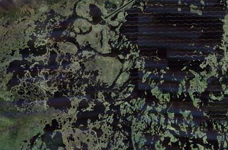
the immense and scarred coastal wetlands[ii].
The land types of Texas are as varied as
the ways in which we’ve gone about mucking them up.
While it’s impressive in its, well, bigness, what’s equally
impressive is the extent to which we’ve modified massive bits of it; creating
green swathes in the desert, altering the course of rivers, and building
sprawling cities that can be seen from space. The human geography of Texas is
as much a part of the landscape as the processes of time, water and wind.
For example, Houston,
which is easily visible from space. It’s the outlined massive grey blob against
the surrounding green.600+ square miles of sprawling impervious cover; larger
than many prominent “natural” features of the landscape (impact craters, etc.)
I’ve always loved maps. Mostly because they fundamentally
change the way our brains think of our environs. Ever since I was a kid there
was something about looking at places on maps that fired up the imagination.
The advent of aerial and satellite imagery adds an even deeper dimension to
that experience. I work a lot with maps
in my job, so I get used to seeing things from the 20,000 foot view. Every once
in a while, I see something in an aerial/satellite image that just amazes me. But I think I’ve come to also appreciate that
our familiar landscapes, even those most mundane and unexciting from the
ground, can turn into unintentional art when viewed from above. It makes for an
interesting juxtaposition with the consideration of the scale of our impact on
the land.
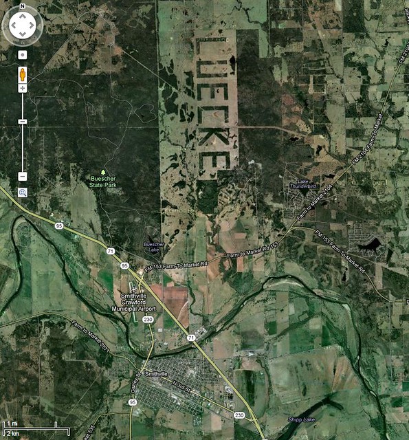
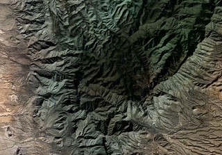
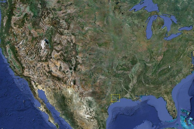
The Leucke woods
are one of my favorite Texas landscapes, especially since there are so many contrasting
legends as to the reason they exist. Look carefully at the lower edge of the
photo…you’ll see the city of Smithville. This should give you an idea of the
size of this man-made alteration. Some stories claim the rancher did it as part
of a property dispute, some say he just felt like it. However, it is apparently
the largest of its kind, at 3100 feet long and 1700 feet wide. It’s so large,
astronauts have used it to calibrate camera technology from space. You
can see a flyover of it here. This is just pure, unadulterated Texas, writ
large (literally.)
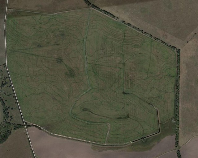
Rice Farming was
a predominant activity of a large portion of southeastern Texas until the
bottom went out of the market and water got scarce. Rice fields have internal
baffles and contours that appear as mounded lines from the ground, but take on
an artificial but beautiful pattern from above. The irony is that they look
like topo maps, though they are often in areas with little or no actual
topographical change.
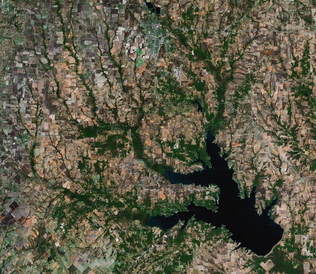
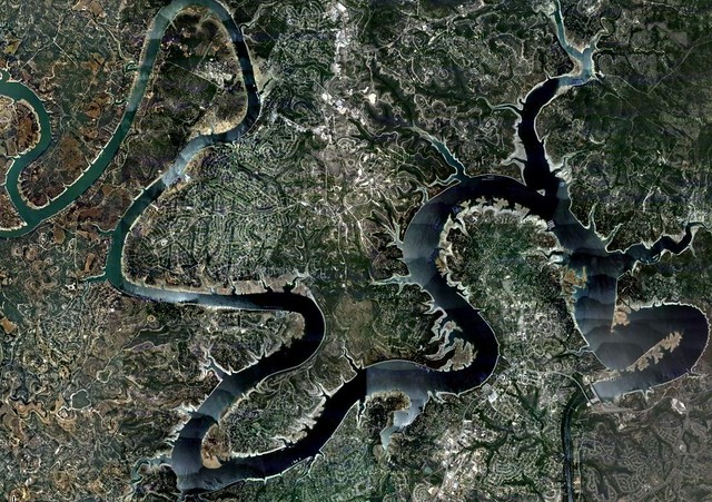
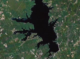
Water Dragons - According
to Texas lore, Caddo Lake on its eastern border is the only natural,
non-horseshoe, lake in Texas. While this is arguably inaccurate, what is true
is that the majority of lakes in Texas are the result of damming projects on
rivers. The vast lakes of eastern Texas[iii]
are almost all reservoirs. The scale of this alteration of the land is hard to
even comprehend for the left side of my brain. Luckily, the right side of my
brain thinks that the characteristic reservoir shape (long, linear, jagged
edges mirroring the drainage basins of the surrounding land) look like some
sort of land-bound dragons roaming across the landscape[iv].
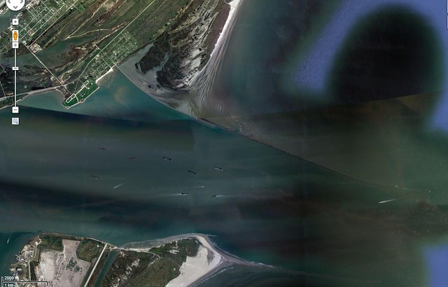
The Bolivar Peninsula
extends eastward from the entrance of Galveston Bay. At its western tip, a
massive jetty thrusts out into the Gulf to protect the narrow entrance to Galveston
Bay from sediment carried by the currents moving down to the southwest. The
jetty is an amazing 5 miles long and has drastically altered the transport of
sediment along the Gulf[v].
North of the jetty, the sediment buildup has created vast mudflats, beaches and
marshes, yielding an immensely productive Audubon shorebird sanctuary.
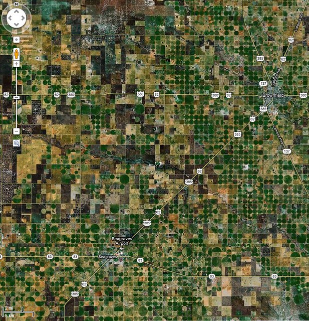
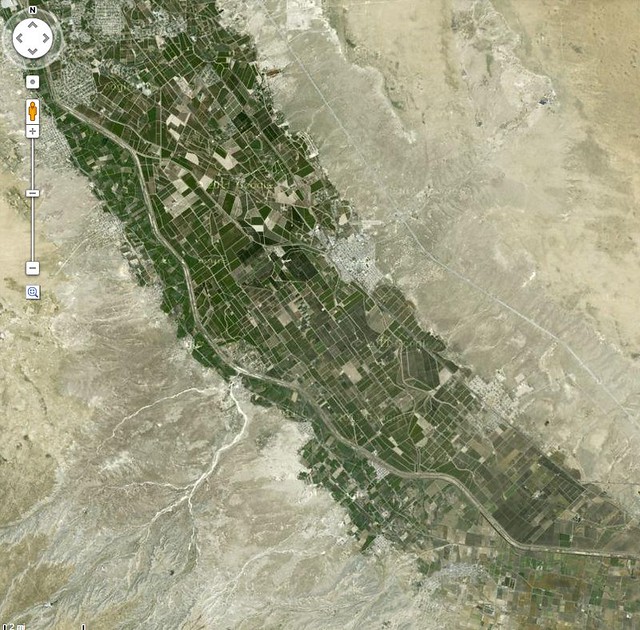
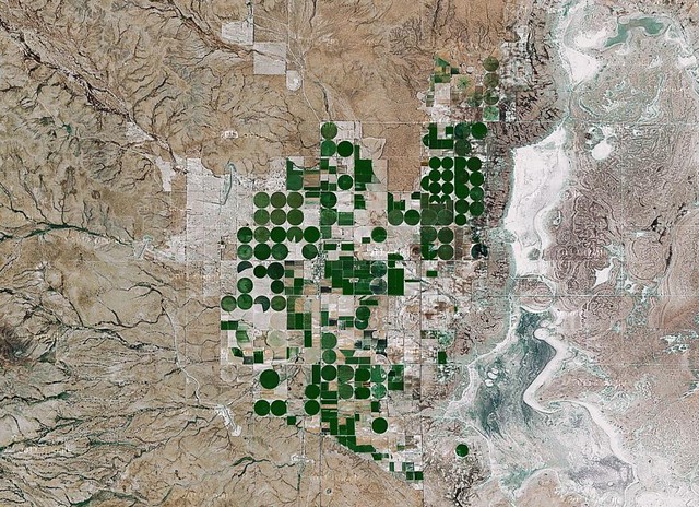
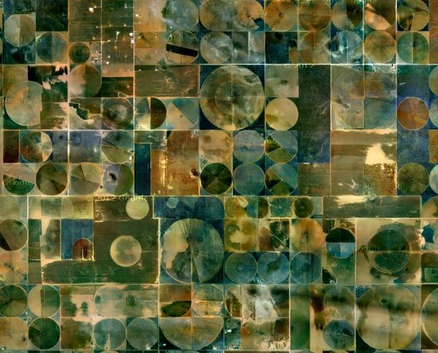
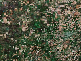
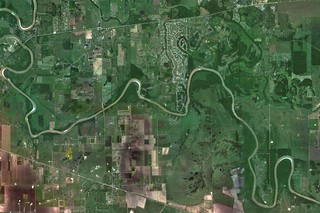
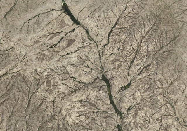
Agriculture has
long been the backbone of Texas, and there is no landscape that has remained
untamed, save the most mountainous extremes. Regions of agricultural fields
form a mosaic patchwork on the land, and stand out in stark contrast along the Rio Grande River and in the arid
regions of west Texas r[vi].
The ability to carve out green swathes in dry and dusty land speaks as much to perseverance
and Texas’ history as it does to the coming firestorm of water scarcity. Yet
again, my right brain takes a break from such weighty left brain considerations
to see the sad beauty of these contrasts when viewed from above.
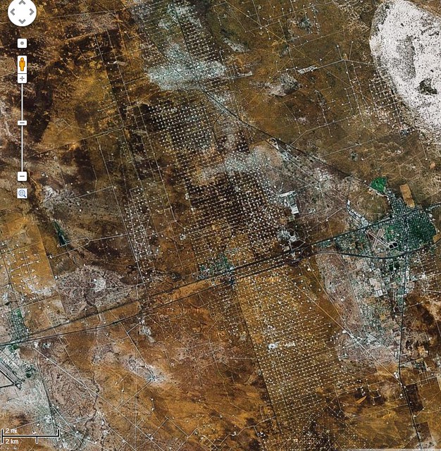
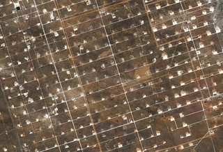
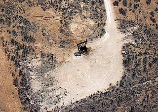
Oil and Texas are
inextricably bound in reality as well as popular image. The pictures above
show, in deceasing altitude, the vast expanse of oil/gas fields in Texas. When
I first flew over west Texas, I thought it curious that so many seeming
suburban developments had this odd circuit board appearance. It wasn’t until
later that I learned that what I assumed to be remote developments were just
the uniform, sprawling well fields. Vast plains of derricks, moving in unison
to some unending primordial rhythm.
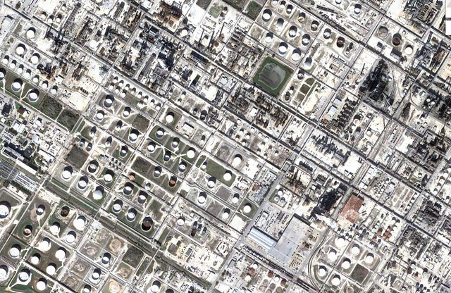
On the other end of things are the lunar landscapes of the
refinery industry of the coast. As much as the scale of the land devoted a
single, unyielding purpose staggers the mind, the view from above is
fascinating. It’s like someone modeled the surface of the Death Star in
unimaginably large Legos.
It’s landscapes like that that make me take some
comfort that the environs of my less-than-beloved place in this vast state
remain a little greener than most[vii].
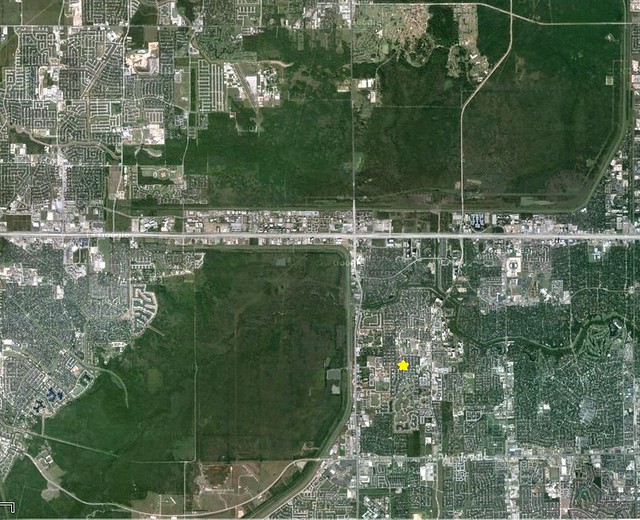
The sprawl-oases of Barker and Addicks Reservoirs, and the linear Terry Hershey Park. House marked with yellow star.
[i]
Admittedly, a good chunk of Texas is exactly this.
[ii]
The small “wave” like features in the open water are some sort of man-made
baffles or breakwaters. This is a great example of the scope and extent that we
have altered the coastal wetlands, mostly for oil production. What’s
interesting is how much has been altered, and how few people know what these
structures once were. Where I hike on the coast, there are a myriad of these
remnants, seemingly without purpose or explanation, like artifacts of another
civilization or alien graffiti. The Texas coast, for all its growth and buzz is
a place swarming with the ghosts of its past, carved indelibly on the land.
[iii]
Again, most of which are visible from space
[iv]
From top, Lakes Tawakoni and Travis
[v] Though
admittedly, this is balanced in some part by the fact that much more sediment flow
out of our rivers than is natural. Some river mouths have actually been closed
by sediment from upcurrent rivers, forcing water into the inter-coastal
waterway than runs parallel to the shore (itself a massive engineering project,
running the entire length of the Texas coast.
[vi]
Second and third photos, respectively
[vii]
That’s of course when stupid left brain breaks in with concerns about location
and equity of the economics of where people live.
No comments:
Post a Comment