
(This is part of a series of posts about our 2011 trip to Iceland. Here are the first, second, third, fourth, and fifth posts.)
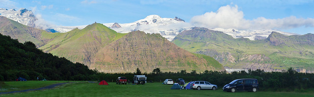
Skaftafell
National Park campground
We awoke the
next day in Vik to the sounds of bird colonies calling from the
massive cliffs behind our campsite. A quick stop for groceriesi
and gas, and we headed back out toward Dyrholaey to see the
Solheimajokull glacier, an offshoot of the Mýrdalsjökull
ice capii,
that we had missed seeing the day before. It was impressive to stand
on the end of such a massive fusion of force and matter, even though
the business end of a glacier is not exactly the most picturesque of
locationsiii.
We got up onto the very edge of the glacier as it terminated in a
valley, and watched much better equipped tour groups make their way
farther up. It wasn't much, but still, your first glacier is your
first glacier.
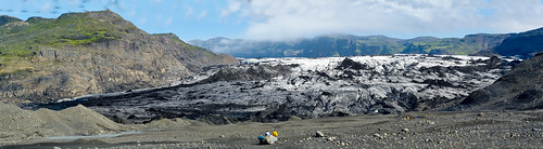
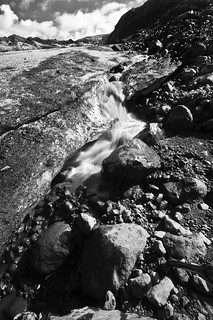
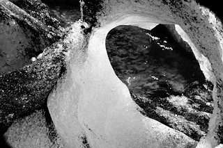
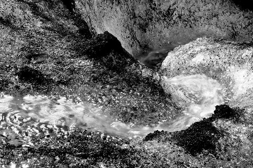
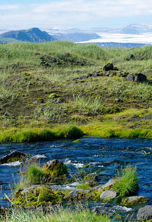
Solheimajokull
GlacierEdge, Glacier approach, Melt pools, Glacial melt, Glacial
abstract, Glacial melt channel
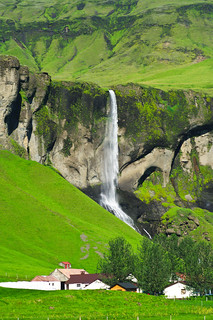
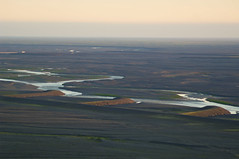
We headed back west, leaving Vik and
heading out toward Skaftafel National Park along the Ring Road. Most
of our trip around the Ring had been pretty similar scenery; massive
coastal cliffs, verdant farmscapes, dramatic waterfalls, and more
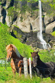
Icelandic horses. As we made our way west from Vik, we entered the
Sandariv.
Technically, it's A sandur, (not THE Sandur)
which wikipedia defines as “A sandur (plural
sandar) is a glacial
outwash
plain formed
of sediments
deposited
by meltwater at the terminus of a glacier.”
While that doesn't capture
the immensity of the place, it certainly captures its vast
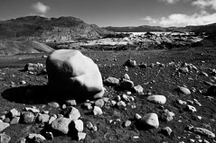
otherworldly emptiness. The lush scenery suddenly gave way to a lunar
surface. The natural force it took to create such a place is an
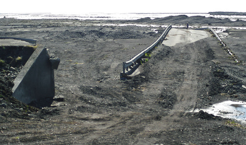
almost incomprehensible abstract, or would be if we didn’t drive
past the ruins of a giant metal bridge that had washed out some time
earlier. Its frame was twisted like it was made of fragile twigs, and
it had been dislocates several hundreds of feet from the road by the
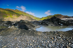
sheer force of the water. There were a few green intermissions as we
traversed between the Myrdasjokull and Vatnajokull outwashes, but for
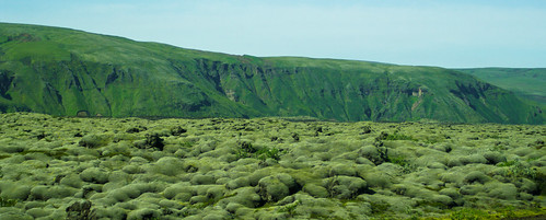
the most part it was a seemingly endless array of volcanic
landscapes, from graveled outwash to odd lava-bubble fields and
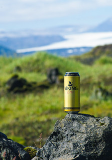
pimpled mounds. We stopped for lunch along the road, in which I
sampled my first Icelandic beer, “Viking”v.
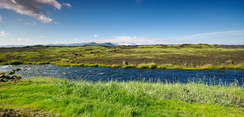
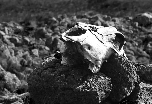
Odd
Vik road sign- Bacon man?, Odd Vik road sign – Beatle crossing?,
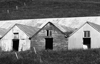
Bridge destroyed by glacial wash, Farm buildings, Viking Beer in its
natural environment, Stream and Glacier, Sandur landscape, Life and
Death in the Sandur, Lava flows, Waterfall and farm, Icelandic horses
and waterfall, Old farm buildings.
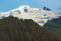
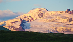
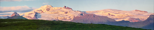
When we first came around a turn and
the vista of Vatnajokul opened up before us, it filled the sky from
one side of the arc of our sight to the other. In the open space of
the glacial plain, its full extentvi
staggered the viewer in its immensity. We made our way into the park
headquarters, which was nestled at the base of a great green finger
of land reaching from the ice cap down to the coastal plain between
massive glacial valleys. We set up camp in a large meadow, and
decided to book a glacier hike for the next day from the uber-hip
guide company entrenched in a turf-roofed shack near the entrance.
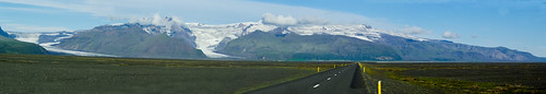
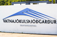
Southern
edge of Vatnajokull, Skaftafell/Vatnajokulthjodgardur Park sign, Arm
of Vatnajokull ice cap.
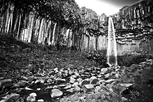
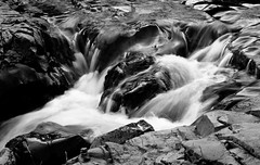
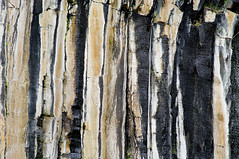
It was later in the day, but we still
had time to get in a short hike, so we set out for Svartifoss, a
well-known landmark waterfall. The hike up was pleasant; the slow
climb up the slope was accented with wildflowers, remarkable views,
and waterfalls. Svartifoss is a small waterfall, nothing spectacular
in and of itself. It’s fame comes from the array of basaltic
columns that flank it on all sides, making it particularly
photogenicvii.
Sadly, even in this land of endless sun, we reached Svartifoss after
its vlley had already fallen into shadow, limiting photographic
opportunities. Even so, Seth and I stayed a while while the womenfolk
headed back to get dinner goingviii.
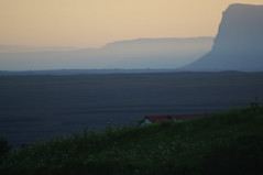
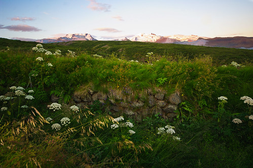
The evening light was fantastic on our way back, lighting up the
ice-covered peaks, and putting the landscape of overlapping ridges
and valleys in the distance into a red, glowing haze of silhouettes.
I was getting pretty excited for hiking the next day as we walked
past ancient stone walls and fields of angelica and bursts of
harebell and crane’s bill wildflowers.
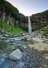
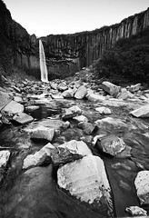
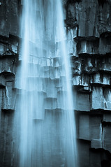
Svartifoss
landscape, Small waterfall on the way, Svartifoss landscape,
Svartifoss, Svartifoss, Sunset vista, Outwash Vista, Skaftafell Vista
at last light, Svartifoss abstract, Walls of Stone and Ice,
Skaftafell vista
Nina and Kate had a wonderful Indian
curry dinner ready for us, and we retired on a full belly in
anticipation of the next day.
NOTES
i
When we were in Spain in 2001, we developed a taste, mostly through
repetition for the soft drink Fanta Limon (lemon), which is not
available in the US. This is not a huge loss, honestly. So I was
surprised to find it in the grocery store in a small town in
Iceland. Its taste has not improved over time, as it turns out.
iiVik
is a quaint-ish little town until you realize that the massive cloud
bank that stretches across the horizon is actually afantastically
large ice cap. And then even less so, when you realize there is an
active, particularly mean volcano directly beneath it. The whole
tike we were there, they kept remarking about how long it had been
since it had blown its top and how devastating the resulting
cataclysmic flood would be. So, drinks on the beach anyone?
iiiGlaciers
push a lot of dirt and stone and stone-soon-to-be-ground-into-dirt
in front of them. We uninitiated think of glaciers as pristine icy
things, but they're pretty dirty, it turns out.
ivIcelandic
place names are just inherently epic. I think I mentioned this in a
previous post, but one can't help but feel a bit epic (in the
traditional/literal Viking sense of the word) when you can casually
say, “I am making my way from Vik, under the looming shadow of
Myrdalsjokull, across the vast wastes of the Sandarr, up the
treacherous Skaftafelshaedi, into the very heart of mighty
Vatnajokull). Just discussing trip itineraries almost requires a
sweeping Peter Jackson musical score in the background. I half
expected every Icelander we met on the way to summon us to carry the
One Ring.
vI
do not recommend it.
vi
And to be honest, we were only seeing the southern extent of the ice
cap, as the full thing stretches far to the north, covering an
appreciable portion of the island’s land mass.
vii
It also has mineral streaking along its side similar to things we’d
seen in Zion’s waterfalls.
viii
In our defense, we took dish duty after the meal, which involved icy
water and sharing space with some truly outstandingly large
orb-weaver spider species, so were not completely living off the
largesse of our ladies’ efforts.
No comments:
Post a Comment