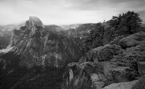
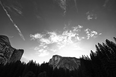
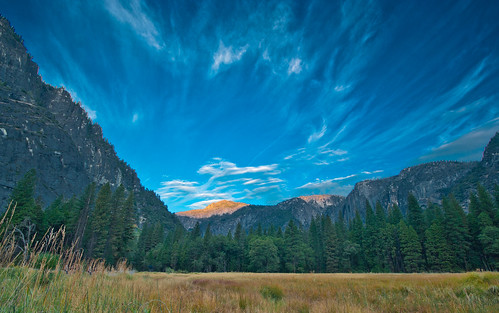
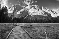
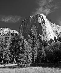
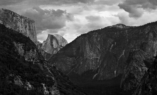
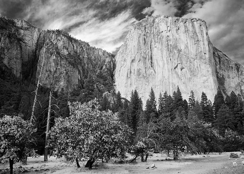
Half Dome from Glacier Point
After greeting our family members when they arrived late the night before, we got in a short, fitful[1] sleep. 4:30 AM came very, very early then next morning. We had decided, in advance of the trip, to leave as early as we possibly could for the Half Dome trailhead to avoid the midday crowds and be back down in time for a nice supper. The rest of our party[2] was only going to be at Yosemite for the day and the next morning, so the hike up Half Dome was to be our big family excursion[3]. It was still pitch black out, when we stumbled out of our tent cabin into the dark morning to meet up with the rest of the expedition, and my stomach was already rebelling from the night before. Everyone was up and raring to go, so, undaunted, we set off for Half Dome.
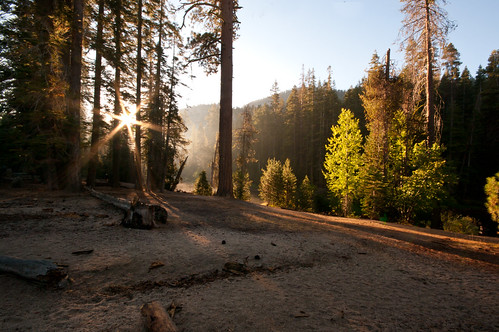
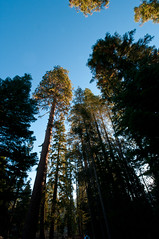
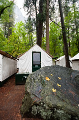
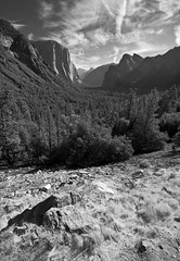
Yosemite Landscape, 4:30 AM.
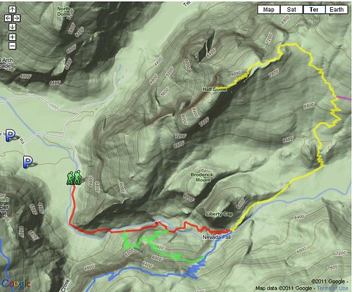
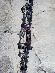
Half Dome is both one of the most iconic features of Yosemite, and also the destination of one of the most popular hikes in the Park. While it doesn’t compare to a technical climb up the sheer face of nearby El Capitan[4], its 17-19 mile[5] round trip distance and vertical climb of approximately 4800 feet[6] to over 8800 feet above sea level at its peak is nothing to take lightly[7]. The typical Half Dome ascent is made along a series of trails, leading to its (north)eastern shoulder, at which point the terminal climb is guided by steps hewn into the bare rock, with a last scramble of several hundred feet of rapid rise guided by cables over almost vertical face. The hike has become so popular that the Park actually instituted a permit system for the final ascent (cables)[8] to avoid massive volumes of hikers on the cables at the same time.
Map of Trails to Half Dome (courtesy of Yosemite NP), Pre-permit Cables Crowding (courtesy of Flickr user Vicki and Chuck Rogers), Aerial photograph (courtesy of Google map)
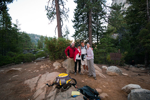
I was excited to have my uncle Dave, his wife Shelly, and his friend Dave hiking with us[9]. Growing up, we hadn’t had as much time to spend with Dave, who was on the west coast, and I’d only previously met his wife Shelly at a few less-than-ideal times[10]. “Friend Dave”’s other half was unable to make it on the trip unfortunately, but we were glad to meet him and have him along[11]. It made for a good small hiking party[12]. Once we all had properly strapped on gear and illuminated headlamps, we set out on the 1 mile hike to the trailhead[13]. While most of us were used to being in bear-inhabited woods, there’s something about being in the woods in the dark that heightens one’s senses immensely, even when not expecting large ursine ambushers. That vestigial fear of the unknown lurks around the periphery of the mind, and without the static of visual distractions, the sounds of the forest at night (early morning) were cacophonous.
Along the way we crossed a bridge over the Merced River. As we stepped out of the dense tree canopy into the open space, the rush of cool air and smell of moving water hit us all at once. Looking up, at first we thought there was a massive cloud above us, until we realized that it was the open sky, outside of the tree canopy. We were all mostly quiet as we passed over, listening to the sound of the running water far beneath us. I should note that I have absolutely no pictures from this part of the trip, so this recounting of travels in a dark place is all based on the sensory images in my memory[14].
At the trail head we ran into a few other intrepid souls, braving the early morning chill. However, for the most part, we had the path to ourselves at the start. It didn’t take long for me to feel the combined effects of unfortunate stomach and higher altitude exertion. But we began the climb up, winding our way thorugh shadowed pockets of rock. We had chosen to take the Mist Trail up, as it was shorter, if steeper, than the lower section of the John Muir trail, and promised better scenery. We passed over Vernal Falls just as a hint of light was cresting over the ridges around us. So late in the season, the falls had just a base flow of water going over them. I was a bit embarrassed I had to stop and rest before the “old guys” in the group. Gradually we made our way up the steep, hewn rock stairs of the Mist trail[15]. Eventually, we made it up to Nevada Falls, just as the light was enough to turn off our headlamps. It was becoming readily apparent to me that I was not in comparable shape/altitude conditioning with the Californians in the party. Part of this is that I’m not a destination hiker. I’m a “stop and smell the roses”/”it’s about the journey” sort of hiker[16]. But this was decidedly a destination hike, and I was with destination hikers, so I tried to keep up as best I could[17]. We sat down for a first stage rest stop at about the midpoint of the Falls, after a series of punishing switchbacks, before continuing on to Little Yosemite Valley.
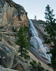
Nevada Falls at Dawn, Nevada Falls from Mist Trail, Rest Stop, Hiking at Nevada Falls.
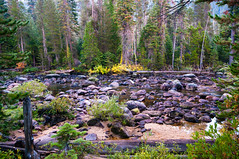
Thankfully, after I finished huffing and puffing my way up the Mist Trail, the path through Little Yosemite Valley was wonderfully flat, and fantastically scenic. I live in Houston…I know all about hiking flat[18]. The sun was just rising, so our sojourn through the Little Yosemite was beautiful, with steam rising from the wet earth and wood, and the sun sparkling off the Merced alongside the trail. This was the one time I allowed myself a quick, non-rest photo stop. Even beyond the flatness, the Little Yosemite was one of my favorite parts of the hike. Bolstered by the scenery around us, my first new species find of the day (a Stellar’s Jay), and some truly outstanding jerky supplied by Shelly, I was feeling much better during this portion[19].
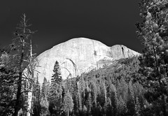
Morning Light in the Little Yosemite, Merced River in Little Yosemite Valley, Morning Breaks over the Little Yosemite, Twisted Wood, Half-Dome from Little Yosemite, Morning Steam, Stellar's Jay.
We had started at the head of the pack of hikers that morning, but ended up having a trickle of people passing us[20] as our ascent continued past the Little Yosemite. I was chiding myself for hiking like a 13 year old girl…..right before a 13 year old girl passed by, leaving me in the dust. Moments of humility are good. The climb up the slope behind Half Dome was mostly wooded, as opposed to the rock face of the Mist Trail, and the smell of the air was almost indescribable. The usual woods smells…the rich and earth spices of decaying leaves and old vegetation and the pungency of green growing things, but also the cool thin air smelled of high places[21].
About halfway up the remainder of the trail, we stopped at a couple large flat rocks to have a “brunch”, and then continued on. On the way up we ran into a mother mule deer with a faun, who seemed to have absolutely no fear of us[22]. After going up what seemed an unending series of switchbacks in the woods we came to an open vista looking at Half Dome’s profile from the northeast[23] and the valley laid out below us, with the higher peaks to the north and east[24]. This was a Keanu moment[25].
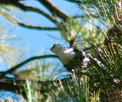
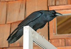
On the Trail, Mule Deer Faun, Clark’s Nutcracke, Sooty Grouse, Half Dome Profile
After a short trek further up the trail, we came into open rock. A short scramble later and we were on a wide plateau with almost 360 degree views of Yosemite. This may be the first time I’ve ever been completely stymied as to what to photograph first. Sadly, we were in the flat light of day, but it was really a scale that no photo could have captured anyway.
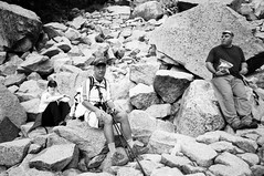
Across the plateau, a ranger stood at the bottom of the final ascent to Half Dome. We dumped our gear at the base, and waitied to see if we could get extra passes. Luckily, there were few people, and many who came took a look at the final ascent, dropped their passes and left. So we were able to get passes for the four of us[26] who wanted to go on. Unfortunately, at this point, what had started as a tightness in my leg after the Mist Trail, had progressed to something worse, and a mix of rubberiness and muscle contractions made me question my ability to safely get to the top of Half Dome. I decided to give it a chance, and we all began to climb the steep rough-hewn steps towards the cables. About halfway up I made what turned out to be a wise, though ultimately regretted decision, to turn back. As much as I wanted to summit, my real fear was being a safety concern to myself and others. I was really disappointed with myself, but went back to the gear and kept Shelley company while the others continued on. It was hilarious to listen to the ranger tell hikers the same stories and warnings over and over. Now that we had some time, I had a chance to get out my camera and take some more pictures. As it turned out, I would not be able to do so again on the way down.
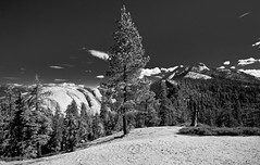
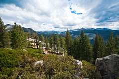
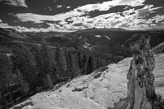
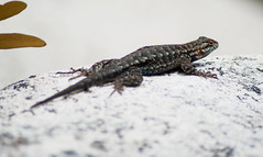
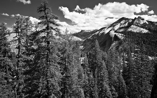
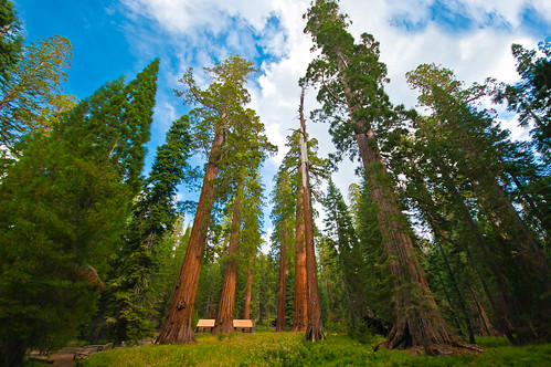
Money Shot- Yosemite Valley, Valley with Conifer, Sierras Vista, Vista with Gnarled Wood, Western Fence Lizard, Vista from Quarter Dome, The Ascent Party
Spoiler - The rest of this post will be without pictures. However, it involves mortal peril! No refunds if you keep reading.
As Shelley and I were waiting for the others to return, and I was kicking myself in the butt for not pushing on instead of turning back, clouds started to roll in across the Valley from the north. Knowning the dangers of being high on exposed rock in a storm, we started to get a bit worried. That worry increased as a few drops of rain started to fall. It absolutely peaked when we got word from returning hikers that a young brunette woman had fallen and might need medical assistance (the description matching my wife Kate). Luckily, not long after this, we spotted our party returning down the mountain[27].
As the clouds continued to gather, we ate a quick lunch on an outcrop high above the Little Yosemite Valley, with the Sierras spread out before us to the horizon. As a light sprinkle of rain came more persistently, we decided to make our descent sooner rather than later. As hard as it was to tear myself away from that idyllic plateau, an aching leg and the promise of a long journey home were good incentive to get started. My wife’s foot had started to hurt badly from an ill sized boot, so our progress down was slowed somewhat. While we were getting on rain gear midway down to the Little Yosemite, we say a helicopter arrive to cart the injured woman on top of Half Dome away[28]. Shelley and I were talking about how we loved the sound of storms, and the smell of rain in the woods, etc. Just about then it began to rain in earnest.
Much of the rain that falls anywhere washes off the land to the lowest point around it. This effect is exacerbated on the steep slopes of mountains. We experienced that effect first hand. As we hurried down the mountain, with my wife hobbling along, the rivuelts of rain that formed on the steep path began to widen. They water began to flow over the path. Then it began to hail. And by hail I don’t mean, a couple pieces of ice here and there. It was a heavy, sustained hail beating down on us. The path beneath us utterly disappeared in a torrent[29] of flowing ice, water and eroded dirt. We had to walk on the narrow shelves on either side of the trail, as it became a river in its own right, whole pices eroding away before our eyes. We were moving quickly down the mountain now, and almost to the point of dropping our packs and running for our lives when we hit the base of the Little Yosemite Valley plateau. Across the plateau was a small set out outhouses, elevated above the floor of the Valley, with an overhanging roof. We made a mad dash across open ground, wincing at the thought of lightning stirkes, and took refuge under the eaves of the building with about a dozen other people. We were a mix of laughing and astonishment and heaving chests when we got there. Our gear was soaked, though luckily most of my camera gear was in waterproof containers. We all joked and laughed and relaxed, but I think it was pretty clear there were a few moments on the descent where we were in serious danger. One couple actually had hiked up with a sixer of beer, but sadly, did not have enough for everyone. I could have used a beer or six.
From here on out there are no pretty pictures, because it ceased to be a lovely walk through the woods, and became what seemed an unending slog over rain slick trail with fading light. My wife’s foot issue had grown to the extent that she was literally hobbled, and almost unable to walk[30]. Our party decided to split up, with Dave and Shelley taking the Mist Trail back down at their fast pace, while Friend Dave, Kate and I made the slower but less steep trek back down the John Muir trail. Dave was an absolute saint, staying with us even as the light faded and the temperature dropped, even going so far as to lenbd Kate one of his hiking poles to support herself. It made for a long trip down, and we didn’t arrive until after 5 PM. SO in total, the trip had taken us over 13 hours of hiking with only slight respites, and a total of more than 17 miles round trip.
By the time we made the trail head, we were utterly exhausted. We limped back into camp, We had all planned on a family dinner, but given our exhaustion and injuries, that got transmuted into a brunch the next day. While Kate went to get attention for her foot, I took off my wet things and got into bed to rest before dinner. However, I had burnt so much energy and been so wet and cold, I began shaking and couldn’t get warm, even under multiple wool blankets. I couldn’t even make myself get up and put on layers because getting out from under the blankets was excruciating. We managed to slump our way into Curry Village for dinner. While we were waiting on our pizzas[31] I stopped in the grocery store, and got a chocolate whole milk and some chocolate mini donuts. Between those and the pizza, I think I managed to replace the complete calories burnt that day in about 5 minutes. After that I felt much better[32], though sleep came pretty easily that night, even as thunder storms boomed their way across the Valley.
All in all it was an impressive hike, one of my top ten ever, even though it may not get as much serious hiker cred as some of the backcountry hikes. I look forward to repeating, and completing, it some time[33].
[1] Yet again, I cannot emphasize how bad an idea it was to load up on way too much heavy food at a late buffet dinner, the evening before a long hike for which I was already woefully unprepared.
[2] My uncle, Dave Swain, his wife Shelley, and his friend Dave, who all live in and around the Sacramento area.
[3] Thank goodness I hadn’t added alcohol to the over-indulgence of the previous night.
[4] Or the longer, road-less-traveled hike to Cloud’s Rest, on the opposite face of the Valley
[5] Depending on the choice of starting point and route.
[6] Starting at roughly 4000 feet above sea level and rising to over 8800 feet
[7] Especially for those of us who have been hiking flat coastal plains at roughly sea level for the last 8 years.
[8] Which we didn’t realize until 2 weeks out, when all the permits were gone. We decided to make the hike anyway, and see if we could get some leftover permits at the top.
[9] I’d never really done this sort of thing with other family members before. My dad’s family all lived in Auburn, so we mostly saw them just on Holidays, and I don’t get the impression they were big expedition-type people. My mom’s family is spread out across the country, so as a kid, our family had mostly done vacations just as a family. Getting out into some serious nature with extended family was something I was really looking forward to, especially in terms of getting to know my uncle in an adult-to-adult sense.
[10] I believe the few times I’d met Shelly (who we think is fantastic) in person, were the funerals of my mother and grandfather. We got along famously, but they’re not the sort of occasions best suited for getting to know someone.
[11] We would be even happier about that after the unfortunate incidents to come….
[12] Although I was somewhat apprehensive about being able to keep up with them, as they are all avid hikers, who had done a lot of hikes in the Sierras and other similar locations during that year and were bound to be much better prepared than I.
[13] Yes, we felt that a 16 miler wasn’t enough of a challenge, we needed to tack an extra mile on both ends by hiking to the trailhead. In our defense, the access road to the trailhead was literally right behind our tent cabins.
[14] In fact, except for resting points, I didn’t take a lot of pictures on this trek at all. We hit Nevada Falls before it was even light enough to get a camera out.
[15] I’m sure it’s totally different in daylight, but in the darkness, with only the wan light of coming dawn, the stairs seemed daunting on both a physical and mental sense. It had a bit of a “we’re hiking through the Mines of Moria” feel to it.
[16] There were definitely some places I would have liked to stop on the way, like Emerald Pool, but time was of the essence, and given the events that happened later, was the right way to go that day.
[17] Everyone but my wife and I had hiking poles. Previously, I had made a good deal of fun of these accoutrements, thinking them gear for the sake of gear, or the equivalent for most people of buying a rugged SUV to tool around the suburbs. I am man enough to admit I was grossly mistaken about their potential utility.
[18] Though not as much about hiking scenic.
[19] Not to rationalize, but I think my hike performance would have been better if we had chosen the longer but less vertical John Muir Trail route from the trailhead. But it wouldn’t have been half as much fun.
[20] Almost exclusively because of me slowing us down. My muscles weren’t overly tired, but the elevation was really getting to me. It felt like I just couldn’t get enough air. I was perpetually embarrassed the whole way up.
[21] In retrospect, it may have just been my Houston “the air is classified as a pollutant here” lungs reacting to clean air.
[22] Which was actually a little sad…they were so habituated to us form the constant stream of people that use this trail. The deer in the populated areas of the Valley were even worse, coming within feet of people.
[23] Having come around from the west behind it, to its northeast shoulder.
[24] Typically, I was caught between admiring this amazing view, and trying to identify a new species of grouse which had run across the road in front of us, and to catch a picture of a Clark’s Nutcracker, a bird most common top these sub-alpine areas, and not easily found. I ended up with a picture of its rear end.
[25] i.e,”Whoaa”.
[26] Shelley elected to stay with the gear at the base.
[27] It was at this point I realized that my choice was probably for the best as I would have taken longer to get up and back, and probably would have caught the worst of the storm still exposed. Still stings not to have made it to the top, though.
[28] As it turns out, this is an expensive proposition, costing the rescuee about $50,000, and not likely to be covered by insurance. Even more amazing was that the rescue literally almost had to be abandoned because of the impending weather, which would have been a life-threatening situation on the exposed rock. Someone has a great, though expensive, story to tell because of this.
[29] This is probably the first time in my life where I have had such an intimate and visceral association with that word.
[30] Murphey’s law was in full effect. With rain, hail, eroded trails, slick rock, fading light, and injuries, we were one puma attack away from being a halfway decent disaster
[31] So much for the victory dinner…
[32] To the point where I offered up my last slice of pizza to a ravenous group of climbers sitting next to us, who accepted it without protestation.
[33] My wife and I had been equal on completions, with me failing to finish the vertigo inspiring last bit of Angel’s Landing in Zion, and her choosing not to finish the ascent of “the Crack” in Killarney provincial park. Now she’s one up on me again.

