
So, while no one was watching, I’ve gone wandering again[i].
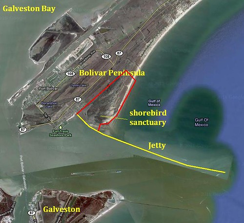
This weekend’s excursion was to the Bolivar Peninsula on the upper Texas Gulf Coast. Bolivar is a low-lying strip of land that separates Galveston Bay from the Gulf of Mexico. I’ve been to Galveston quite often, but never jumped across the water to Bolivar[ii].
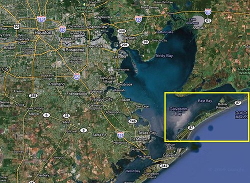
Bolivar Peninsula, from my orbiting Space Lair
I left in the wee hours of the morning and drove the width and breadth of the land[iii] down to Galveston Island[iv]. Galveston was a happening place in the 1800’s until hit by the worst natural disaster in US history[v]. Now it’s an odd amalgam of turn of the century architecture, cruise ship docks and tourist beach houses. Like a lot of old cities, once in a while you catch a glimpse of a layer of history poking up from underneath the new development[vi].

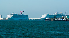


Megacross near Highway 45, Galveston Cruise Ships, pre-1900 architecture, ditto.
From Galveston, there’s a free car ferry across the channel to Bolivar. This was actually a pretty fun ride. Gulls swarm over the boats, dolphins leap in and out of the water, and you get a close up view of a working ship channel. Houston has, buried in miles of refinery wasteland, one of the more active ports in the country and it shows here at the narrow neck between Galveston Bay and the Gulf.
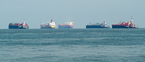

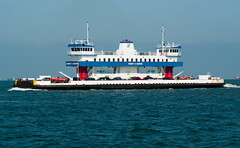
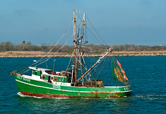
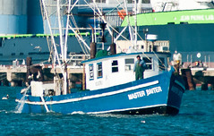
Port Traffic, Laughing Gull Swarm, Ferry!, Fishing Boat, the HMS Master Baiter.
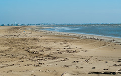
Upon landing, Bolivar was….not what I expected. I didn’t expect the white sand beaches of Florida[vii], but the whole terrain seemed completely incompatible. The width of the peninsula can’t be more than a half a mile to a mile at its most, but the terrain changes (in the absence of any real elevation) from coastal marsh and beaches to, well, scrubland, oil derricks and cactus in the “interior”. No more than a couple hundred yards from the beach were cattle grazing on what could have been a scene from West Texas. It was surreal.
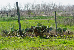

Cactus and Scrubland, Oil Derrick abstract.
It was also pretty obvious that even with new buildings abounding, much of Bolivar still lay in ruins.
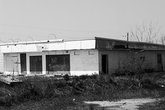
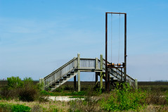
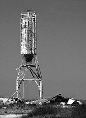
No Trespassing, Stairway to nowhere, Junk and Rust.
When you look up “devastation” in a dictionary, post-Hurricane Ike Bolivar Peninsula is right there on the page, waving feebly[viii]. While most of Houston escaped the worst of this 2008 megastorm, Bolivar bore the dirty-side brunt of Ike’s fury as it came ashore, with some communities simply ceasing to exist.

Bolivar pre- and post-Hurricane Ike (USGS)
After receiving what amounted to the world’s largest “It’s not you, it’s me” brush-off from Mother Nature[ix] (as it had in storms past) one might think that Bolivarians would reconsider their choice of Gulf-front, sea-level, hurricane-alley real estate investment. One might also suggest that maybe this should have been somewhat obvious prior to the fact.
One would be wrong. Woefully, woefully wrong about the tenacity of the Texas independent streak. Texans weren’t willing to be kicked out by Mexico, so they sure as heck aren’t going to be kicked out by an amorphous weather system. Instead, local residents are defiantly going out of their way to build the biggest possible houses as close to the water as possible, supported by tall wooden stilts mired in sand. While much of the peninsula is still in ruins years later, an equally staggering amount is being rebuilt bigger and taller, even among the shells of previous buildings. Home is always home, regardless of whether it makes rational sense to live there.
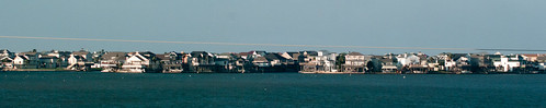
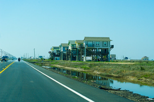
Tiki Island near Galveston, Tall Houses on Boivar
I usually like to find a local place to eat when I’m on a road trip rather than a chain restaurant. Bolivar seemed to have neither. So, armed with a bag of trail mix, I set out for the shorebird sanctuary.
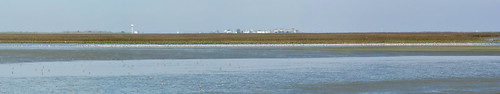
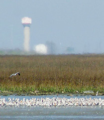
Shorebird Sanctuary north of Bolivar Jetty (via Orbiting Space Lair)
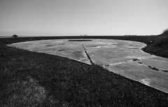
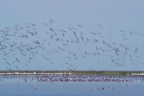
The shorebird sanctuary, run by The Audubon Society as part of a string of local sanctuaries, is really the result of a super long jetty that extends out into the Gulf to create an entrance and exit for ship traffic. The current along the gulf shore drops tons of sediment against the north side of the jetty, causing a large extended marsh/mudflat to build up over time. This has proven to be amazing shorebird habitat, ranging from constantly shifting beach and sandbars in the water to densely packed cordgrass flats and open mud flats in the interior. There were also a few odd sections near the shore where it almost looked like a very solid soil or manmade layer eroding away with sand underneath, but as far as I know there was not a road here[x]. Once in a while out mucking about with the natural environment inadvertently creates something pretty darn cool. I accessed the sanctuary[xi] through an access road to the beach, but from there on, it was beach driving[xii].
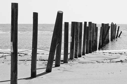
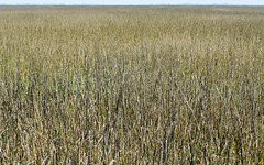
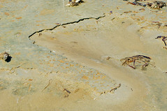
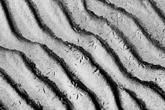

Line in the Sand, Marsh Grasses, Weird Soil Layers, Shorebird tracks, Sanctuary "Beach".
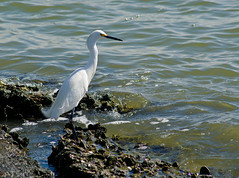
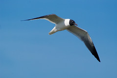
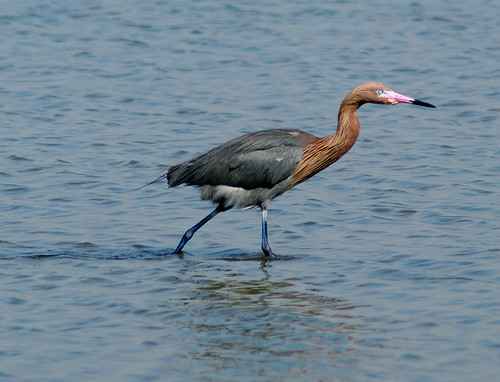
It was fairly secluded, with only one other family sharing the beach with me. I waded out into the water to a sandbar that paralleled the shore, and took in the area. Shorebirds, gulls, terns and Pelicans were everywhere. Almost every shorebird I’ve ever seen was here in one place in staggering numbers. Vast flocks of White Pelicans wheeled above the marsh in the distance, and Avocets lined the waterways by the thousands. It was a pretty interesting place to visit, although I didn’t see much life except the birds.
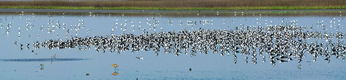
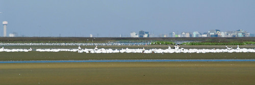
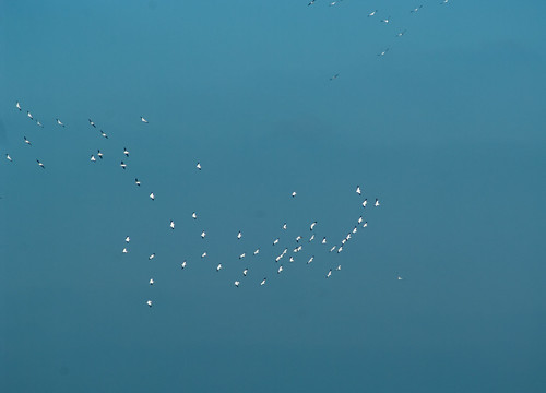
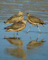
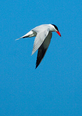
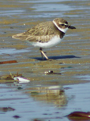
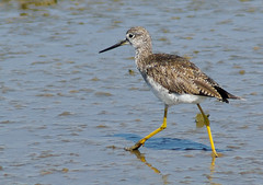
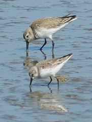
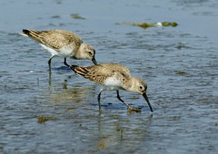
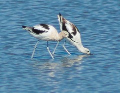
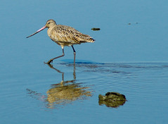
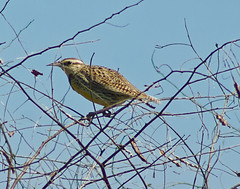
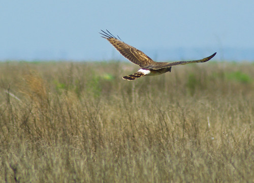
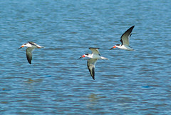
Black Skimmer flock, White Pelican Flock, Pelicans in the Air, Long-billed Curlews, Caspian Tern, Plover, Greater Yellowlegs, Western Sandpiper, Dunlins!, American Avocets, Marbled Godwit, Eastern Meadowlark, Northern Harrier working the Marsh, Massive Avocet flock, Closeup of small portion of Avocet flock.
I was also somewhat dismayed by the sheer amount of trash. A couple hurricanes, lack of staff to clean the area, and the bounty of the tides in a big port city have left trash strewn across the beach. But hey, when life gives you lemons, you make lemonade[xiii]. So here is trash turned pseudo-art.
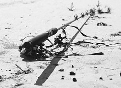
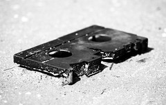
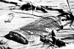
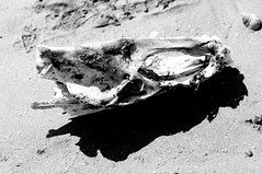
Surf Rod, VCR tape, Liquor bottle, Skull.
After seeing what I could see from the sanctuary, I headed back down the island to try my luck on the jetty. On my way there, however, I stopped by Fort Travis Park, and old coastal gun fortification. The fortifications remain, but none of the guns are there, so there wasn’t much to see.
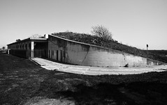
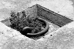
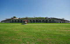
Earthworks, Gun emplacement, Anchoring chain, Fort Travis emplacement.
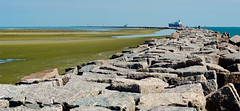
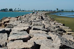
Given that the jetty is several miles long, I decided against doing its entire length[xiv]. However, the area north of the jetty included an expansive mud flat that reached to open water on the east and the cordgrass/etc marsh on the north. It was chock full of shorebirds in staggering numbers. There were several thousand Avocets, hundreds of White Pelican, hundreds of Black Skimmers, and a seemingly nonstop assortment of terns, gulls, shorebirds, egrets, etc. Like most coastal jetties, piers, and shorelines, the jetty was packed with fishermen. Unlike more sport fishing oriented areas, a lot of the people here seemed to be subsistence level or routine fishers, though there were a few birders[xv]. The flocks were so massive that sub-flocks of birds large enough to fill my view could take off from a grounded flock, and the remaining group would look no smaller than it had before. I found a few more new birds for the day, and then decided to head back home. I don’t think I’ll go back any time soon, but it was worth a wander.
[i] My general philosophy of travel, as opposed to my wife’s and that of many other sane people, is that too much planning ruins opportunity. Some planning is necessary, to see what you really really want to see, but when you plan every last detail and “travel out of a guidebook” I think you miss really getting to experience a place. With the cost of airfare, scarcity of vacation time, etc, of course we need to maximize our travel, so it’s those day trips, road trips and accidental city crawls that represent a great opportunity to just wander. I have met some really interesting people and happened upon some great things just by going to a place without too many preconceived notions. You don’t really get a sense of a place until you’ve walked a bit of it.
[ii] Some explorers are driven by noble goals or grandiose ambitions. My excursions follow the much more humble thought process of A) Have I been there? No? Awesome. Going. B) Is there wildlife or anything to look at? Yes? Bonus points. My tentative reason for going was to see the Bolivar shorebird sanctuary, but that really was just an anchor for the trip, and not its purpose, per se.
[iii] I am nothing if not mi-grat-or-y, coconuts or no.
[iv] Galveston is on a long barrier island fronting the Gulf.
[v] In terms of human life loss, which numbered in the thousands.
[vi] While I don’t think I could ever be wholly an urban planner, as I’m more likely to ascribe to the “infernal machine” perspective of urbanity, the layers of history in cities always fascinate me. How all our generations just settle out into historical strata, leaving behind the fossilized remains of their infrastructure lurking beneath the surface. In reading this it should be apparent I am married to a geologist.
[vii] Galveston is known for its brown mud beaches and chocolate milk water.
[viii] It is also appears next to “submerged”, “foolhardy” and “WHAT THE HELL WAS THAT??”.
[ix] I don’t mean to be insensitive; Ike was incredibly devastating in property loss and there were lives lost as well. It’s not a ha ha funny situation, but more of a “staggers the mind” one.
[x] It looked almost like the sort of porous dioxin-laden sand I had seen on a superfund site, so I left it be.
[xi] It’s a sanctuary in pretty much the loosest term of the word. There are no facilities, no on site staff, no real interpretive presence. A barrier to vehicular traffic on the beach is pretty much the long and short of it. It’s a grand conservation easement, but it’s relatively wild for all its popularity.
[xii] Many of the coastal beaches in Texas allow on-beach driving. This is mostly possible because we don’t have the soft sandy tractionless beaches that are, you know, nice to be on. We have dense mud/sand beaches so if you have souped-up offroad vehicle, you can traverse them just fine. If you have a Mazda3, then you can traverse them by keeping constant momentum and praying really really hard to whatever deity or deities you are willing to appeal to.
[xiii] Or just, you know, sell the lemons and buy whatever it is you like better than lemons. Given that I cook with lemons all the time, I’ve never really empathized with this saying. When life gives you lemons….it’s really cool? Yay free lemons? Apparently lemons were not as popular in days of yore.
[xiv] The cool thing for birders, however, is that extends so far from shore that you can often see pelagic birds you would not normally see if you were to walk out far enough.
[xv] The birders are easy to spot, as they are often solitary, carrying $1000 binoculars or cameras with lenses big enough to sleep inside in a pinch. An especially characteristic behavior ocdcurs on spotting a rare bird, etc, in which they will become excited, turn to the people on their right and left, realize that no one else cares, then look dejectedly at their shoelaces. While I don’t consider myself a birder, I have had those moments.
4 comments:
When I worked for BP in the Gulf of Mexico - I joined my team every 6 months for a beach clean-up at Bolivar Flats. Always a filthy mess - from the trash swept overboard from all of the cargo ships, and the trash accumulated from the shore from years of hurricane battering. I was always struck by the incredibly high number of broken down helium balloons recovered... which made me think twice about all of the well intended helium balloon launches that I participated in as a child. I no longer support that industry...
Excellent Birds (This is the picture)
The before and after photos of Bolivar are staggering. Was there any reason why those two buildings happened to be spared, or just random luck?
random luck. That's from Crystal beach, one of the communities that just got wiped out completely. If anything was left standing it was just by sheer luck. They just noted those two so that you could orient the before and after.
Post a Comment