Iteration 1: The East Coast - New York, without borders, is the gateway, in more than just a geographical sense, between New England and the rest of the country.
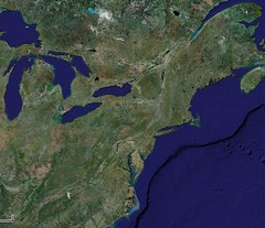
Iteration 2: New York and southern Canada- The Finger Lakes and the Adirondacks are clearly visible, taking up huge swaths of the state
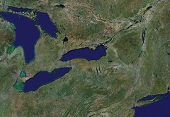
Iteration 3: Upstate NY - the vast amount of the state that is not in the City, to the continual suprise of the rest of the country. Cities become visible against a background of green and tan agriculture
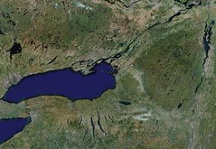
Iteration 4: Northern New York - bordered by Onondaga to the west, the great St. Lawrence River plain to the north, and the Adirondacks to the east, home was compromise between the extremes around it.
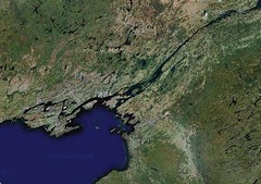
Iteration 5: the North Country- the scattershot placing of the Thousand Islands congregate at the meeting of the Lake and the River, at the same point as the meeting of countries.
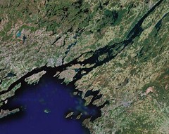
Iteration 6: the Frontier - as the farmland of the I-81 corridor falls away to the southwest, the land grows rugged and filled with massive glacial features and pathworked lakes as it follows the River to the Ocean. Place names become smaller, more disparate, an expanding universe even as our view contracts.
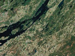
Iteration 7: Indian River valley - as with their larger counterparts, a new River and series of Lakes in the Theresa area take up the banner of crossroads at this new level. The lack of cultivation in the lakes area speaks equally to the changing character of the area as well as the ancient and indomitable forces underlyaing the land. This is a place in which humanity is at best in a fragile coexistence with the place it inhabits. There are no conquerors where survival hangs on a patched and coughing furnace holding back the winter cold.
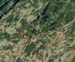
Iteration 8: Theresa - a tiny mill town whose heyday is as past as it was brief. a small settlement perched on a glacial wilderness. And a river runs through it, and connected us all.

Iteration 9: Southwest Theresa - two large areas of wetland surrounding Black Creek and tributaries to the Indian River meet along a narrow strip of rt. 37.
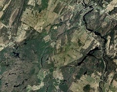
Iteration 10: Douglass Crossings Area - a hamlet, a few old houses stand sentinel around a crossroads, a gateway to the northern frontier for those traveling from Watertown. Completely dwarfed by the wilderness around it.
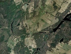
Iteration 11: Douglas Crossings - some houses come into view, and the railroad is more prominent. The thin connecting stream passes between the large swaths of undeveloped land.
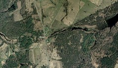
Iteration 12: Douglass Crossings south - the southern side of the small hamlet, a condensed monument to the town's frontier past...an old railroad's path, the remnants of a cheese factory (now making ice) to the NE, and the large stately farm manors built as a futile statement against the vast emptiness of the landscape.
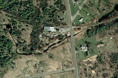
Iteration 13: The Douglass Mansion - a name as overly ambitious in describing the old farmhouse as the farmhouse itself is as an attempt to erect the permanence of civilization against the north country sky. An old Barn ruin speaks to its past, a new garage to the present. Even at this closeness, it is an incomprehensible distance from the psychic landscape of my childhood.
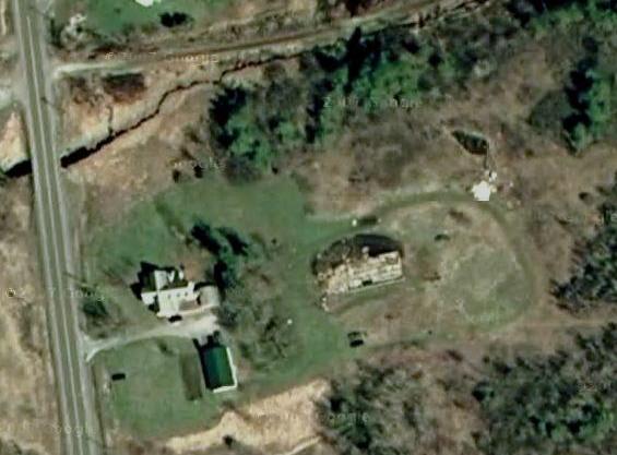
Iteration 14: You Can't Go Home Again - the motif again...at the crossroads of my past and future, at the intersection of the real landscape and the emotional one is a clear sign. You cannot go back, you cannot be where, and more importantly, when, you used to be. You can view it from afar, even while there, but we bear distance as our first child.
Iteration 15: Me
In our first years, we had a garden. Our parents were ambitious, they put their mark on the land. We dug into the dark fertile earth. I remember the smell...layered and old in the fall, moist and smelling of green growing things in the spring. But always rich. And from that soil grew corn, flowers, tomatoes until life got in the way and we let it go fallow again. I want to dig my way back through the years, to smell the richness of a time and place, to see it bear life again. I can't seem to get deep enough to find that fertile darkness anymore.
At the crossroads New England, at the crossroads of a Great Lake and a great River, at the crossroads of a river valley and the wilderness, at the crossroads of tributaries, at the crossroads of a hamlet, at the crossroads of a town and its past, is my crossroads.

3 comments:
I was inspired to try this with my parents' house, and ran into the same issue as you. I can get close enough to see that the motor home was parked by the garage last time they took a satellite photo, but no closer. That's fine, though, since that's closer than I want to be to Philly on most days, anyway.
I actually did this exact exercise when I first got Google earth. I love how you captured how each scale is a part of your story.
I think a lot about the glacial landscape of NNY. For 2 decades it was just how the world looked. I was surprised to find out that most of the country doesn't have house sized boulders scattered throughout their woods and fields.
I was trying to find a good way to conclude the post when the last enhancement left me with the "no imagery at this level".
that really tied it together, mentally, for me in terms of concluding the "you can't go back again" theme.
cheap GIS irony.
Post a Comment